|
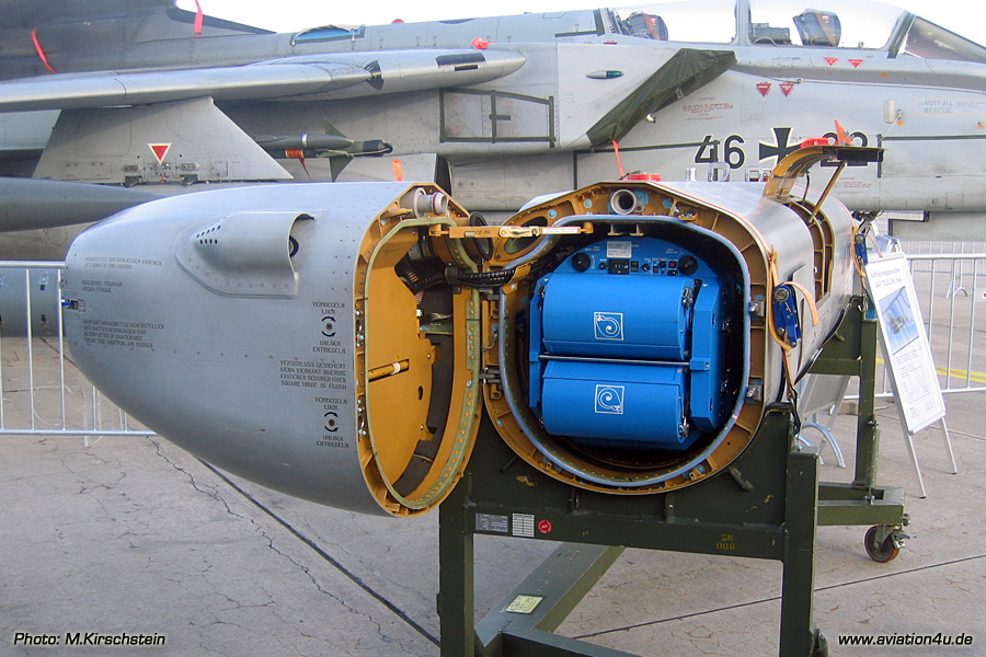
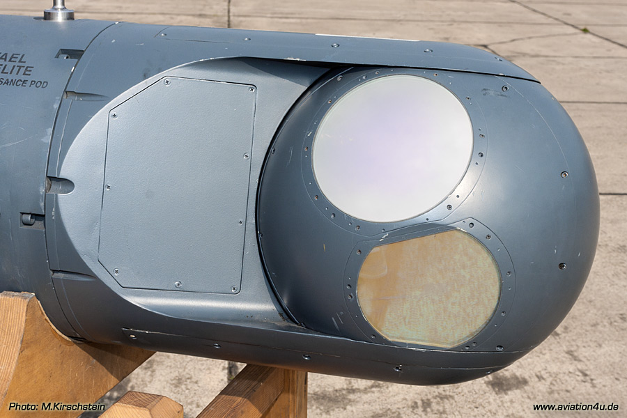
Zeiss-Camera KS-153 Telens 610
- schwenkbar eingebaute Teleobjektiv-Kamera /
tiltable inserted
telephoto camera
- modulare Bauweise /
modular construction
- normal 5 Linsen /
normaly 5 lenses
- 610mm Brennweite /
610mm focal length
- für große Höhen /
for high altitude (more than 2000 ft)
Zeiss-Camera KS-153 Pentalens 57
- 5 Linsen
/
5 lenses
- 57mm
Brennweite
/
57mm focal length
- vertikal
montiert /
vertically installs
- 182,7° Abdeckung (Horizonz-zu-Horitzont-Aufnahmen
möglich)
182,7° Presentation (horizon to horizon
photographs possible)
- 2.580 Bilder /
2580 photographs
Honeywell InfraRed-Linescanner
- für
Schlechtwetter und Nachtaufnahmen
for bad weather and night photographs
- 180°
Blickfeld /
180° field of vision
-
Datenrekorder von Ampex DCRSI 107
Data recording on Ampex DCRSI 107
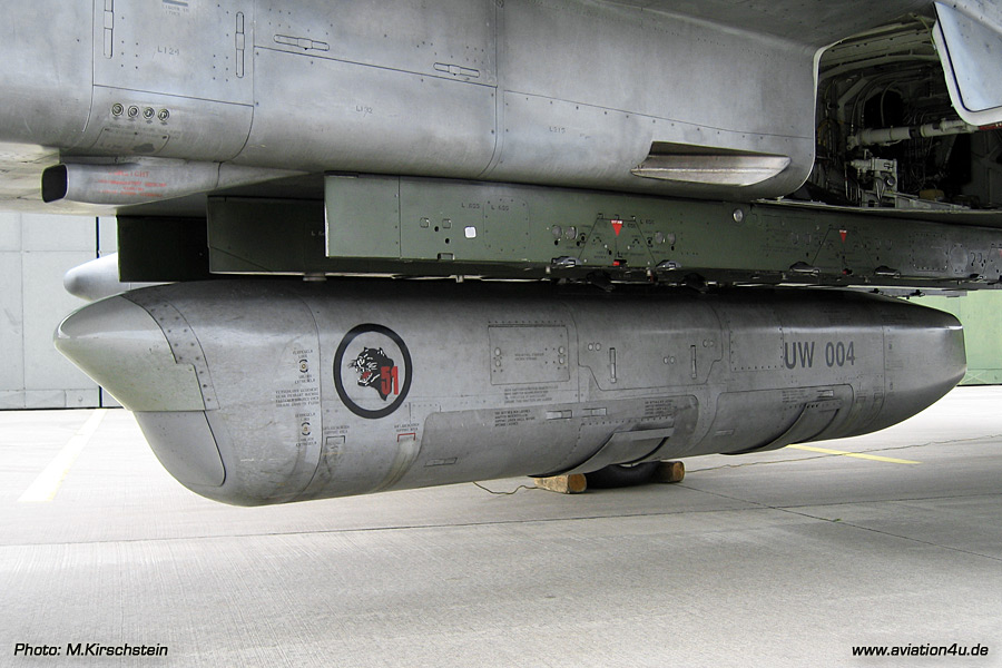
Characteristics
- taktische Aufklärung in
mittleren/großen Höhen
middle/ high level
tactical reconnaissance
- Allwetter
Tag/Nacht tauglich
day/night, adverse weather operation
- Einsatzhöhen zwischen /
operating
altitude:
2000 ft - 8000 ft
- Einsatzgeschwindigkeit: /
operating speed:
300 kts - 600 kts
- Länge /
lenght:
4637 mm
- Breite /
width:
644 mm
- Höhe /
height:
665 mm
- Gewicht /
weight:
710 kg
- Max "G": +7,8 / -1,0
- Einsatzdauer /
Life time:
4000FH or 25 years
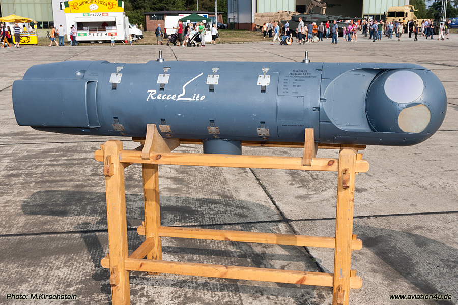
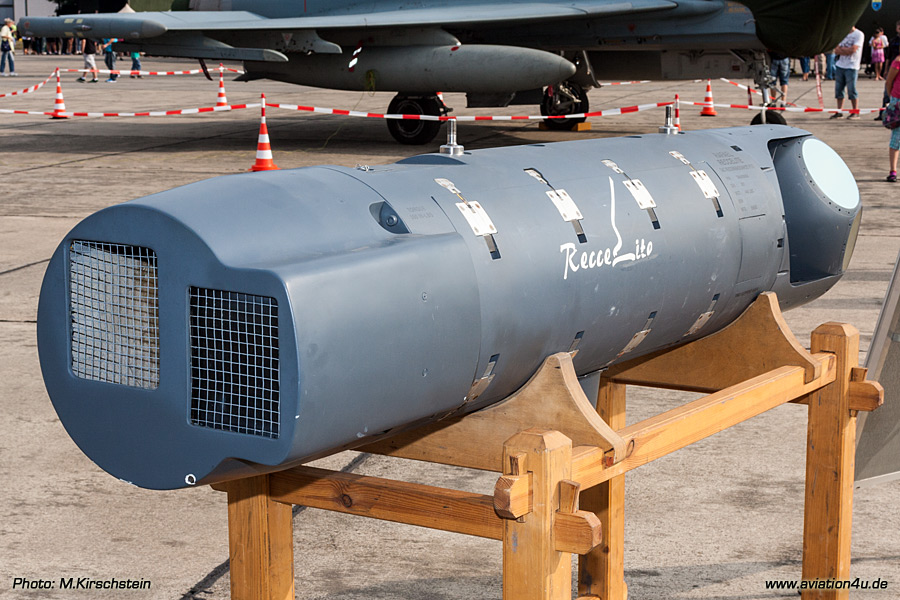
Sensors
-
KS-153 Trilens 160: 1200 Photos
-
KS-153 Pentalens 57: 2450 Photos
-
KS-153 Trilens 80: 1850 Photos
-
Infrared Line Scanner: 64 minutes (digital)
|